Sensor Data Storage System (SDSS)

Sensor Data Storage System (SDSS) http://sdss.caiag.kg is a storage in the form of a database containing data from sensors of measuring stations and it serves for their use and management. Development of SDSS was performed within the framework of the CAWa project (Water in Central Asia), and the system maintenance and data support is carried out from CAIAG funds.
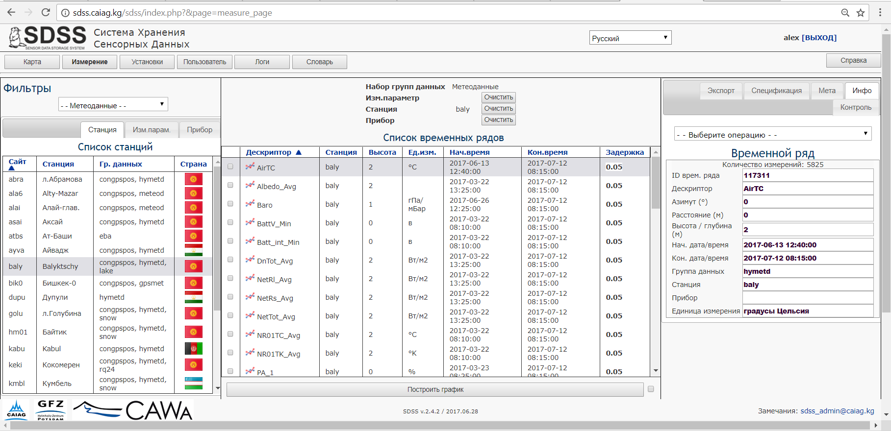
Work with SDSS is carried out in a special program, through the Web-interface, which consists of several pages. The content depends on user's category. For unregistered users and registered specialists, 3 pages are available: Map, Measurements and Reference.The first two allow you to search for time series among others by a table or a map
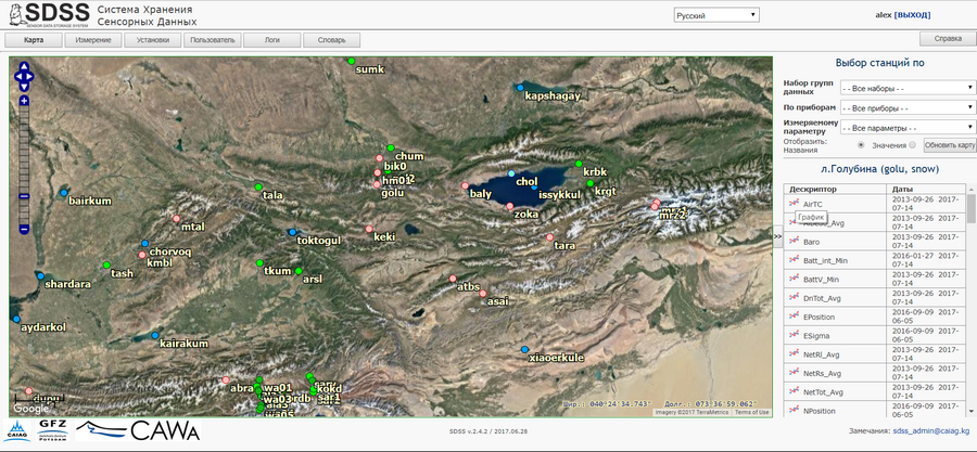
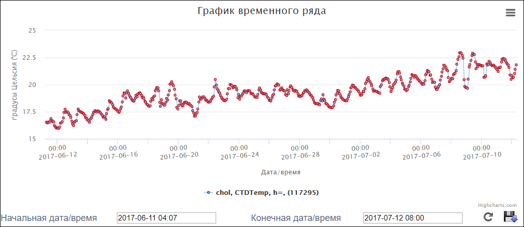
and display data in the form of time series graphs
SDSS is a multi-lingual system and can be used in any language. To include a new language, any user can act as an interpreter, translating all the terms of the system on a special SDSS page.
Most of the data in the SDSS is free. Any user can go to site without a registration request, find the necessary time series on a map or in the table, display them as a graph and save the data in a graphic or digital form to his computer. The SDSS database contains hydro and meteorological data from all stations installed within the CAWa, the Global Change Observatory projects and others. In addition to hydro-meteorological parameters, the surface level of many Asian reservoirs calculated by the specialists of Section 1.2 GFZ from altimetric satellites can be found here