Mass digitization and updating of urban and rural cadastral maps

The project was implemented with the support of the World Bank.
The topographic and cadastral maps of the Chui oblast were scanned, georeferenced and vectorized on 30 layers under the "Mass digitization and updating of urban and rural cadastral maps" project.
3145 maps and map boards containing 425 968 real estate plots were scanned, georeferenced and vectorized, and about 10 000 GPS measurements for geo referencing were performed.
Layers were organized in the form of personal geodatabases with built-in mechanisms for verifying topological correctness. The layers and GIS-projects were created using the ArcGIS 9.3-10.1 software.
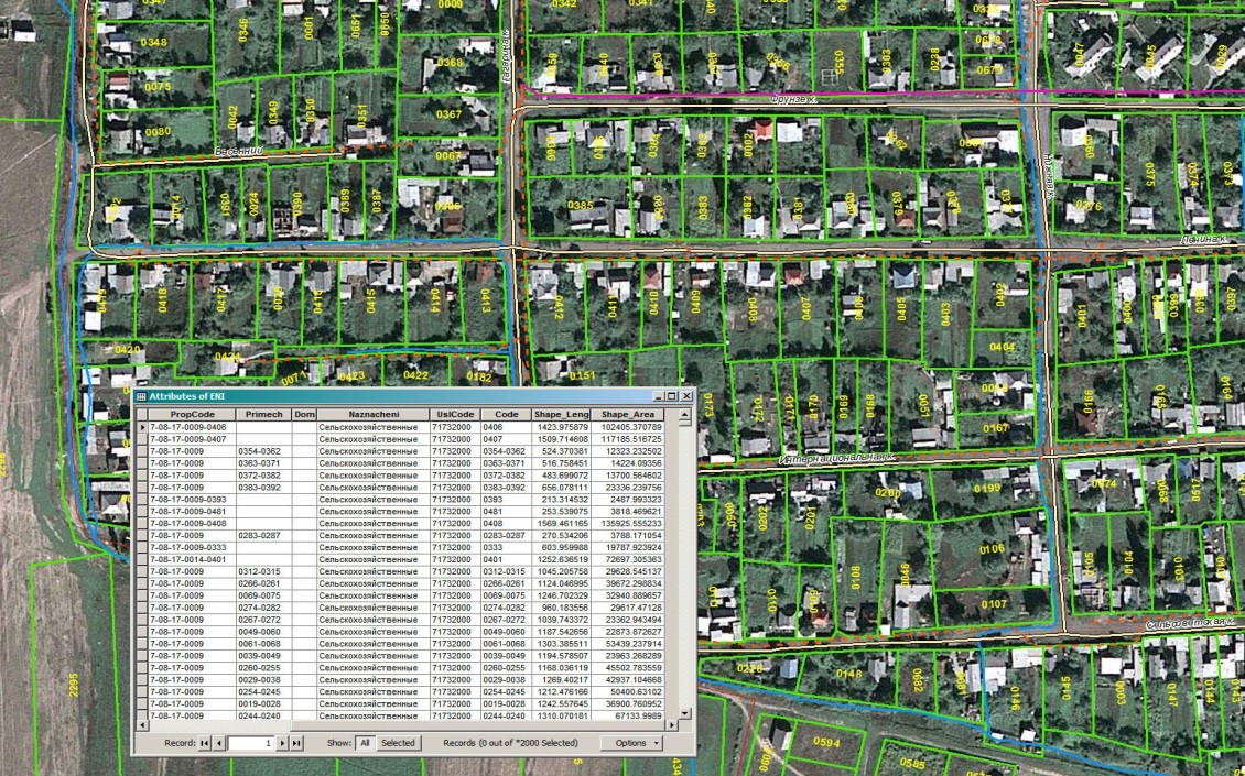
Fragment of the cadastral map vectorized by the satellite image