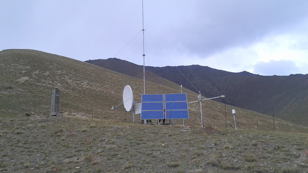
Kabul (KABU)

Common information
- Coordinates N 34.53558408° and E 69.12289046°
- Height above sea level 1813 m
- Installed by CAWa project in 27.01.2015
Station control and power supply
- Computer on base PC-104
- Management of separate device power
- Autonomic system of power suply from 6 panels and 6 batarries
GNSS station
- Receiver TPS GB-1000
- Antenna TPS PG-A1
- Antenna height 0.0.
- Data downloading with use COM port
Meteo station
- Air temperature and humidity sensor Vaisala HMP 155
- Air preassure sensor Setra 278
- 4-component solar net radiation sensor Hukseflux NR 01
- Wind direction and speed sensor R.M.Young 05103
- Rain gauge R.M.Young 52203
- Soil moisture sensors in 10 cm to a depth of 1 m Campbell CS 616
- Soil temperature sensors in 10 cm to a depth of 1 m Campbell CS 616
Data transfer system
- Main satellite system VSAT with router iDirect 3000
- Reserve satellite system Iridium
Meteorological data available in sensor data storage system
